
Backpacking to Hungry Packer Lake (Bishop, CA) - Trip Report
Sabrina Lake is a very popular spot nestled in the Sierra Nevada mountains just outside of Bishop, California. Here you can find some crystal clear water, stunning fall colors, and great fishing. But, if you’re willing to put in some hiking, you’ll find it only gets more beautiful the deeper you get into the mountains. My friend Kaitlin and I set out on a 1-night backpacking trip from Sabrina Lake to Hungry Packer Lake. Along the way, we witnessed some breathtaking views that no video or picture could bring justice to.

Hiking Information
Location: Inyo County - near Bishop, California
Trailhead & Parking: Google Maps
Date Hiked: September 7, 2019 - September 8, 2019
Trail Type: Out & Back
Elevation Change: 2,802 ft
Distance Roundtrip: 13 miles from Sabrina Lake to Hungry Packer Lake (we ventured around to Moonlight Falls and other parts of the trail which made our trip ~16 miles)
Nearest Restrooms: Sabrina Lake Campground
Fees: An overnight permit is required for any backpacking trip in the Inyo National Forest, which has a fee on recreation.gov. Day hiking this area does not require a permit and has no fees.
ID# on Recreation.gov: JM17
Season Accessibility: June - October
Trail Tip: Going during a weekday will guarantee less crowds on this very popular trailhead
The Drive/Parking
You’ll head up towards Sabrina Lake area from Bishop, CA which takes you up a couple thousand feet. Once you arrive, make sure you park in the correct area as there is day use parking (closest to Sabrina Lake) and then there is overnight parking for backpackers. Overnight parking is about half a mile back by the Sabrina Lake Campground, use this map as reference.
The Hike
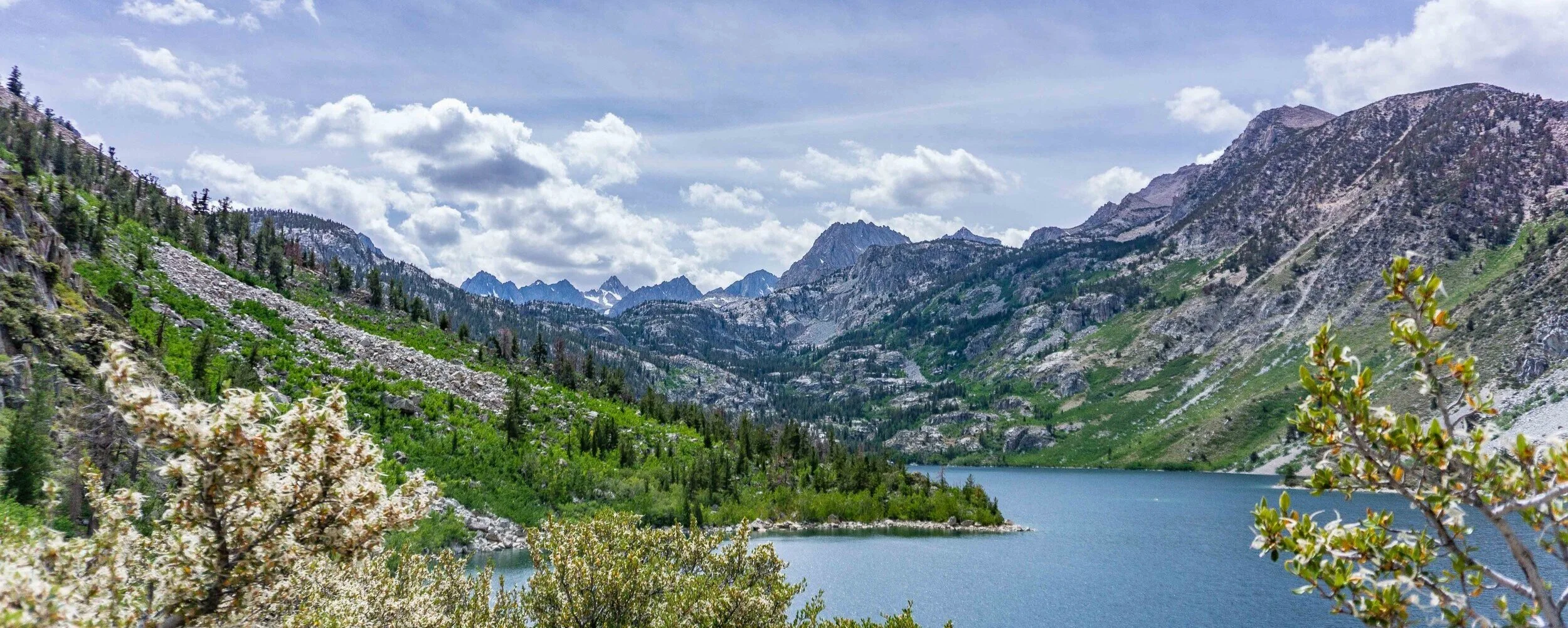
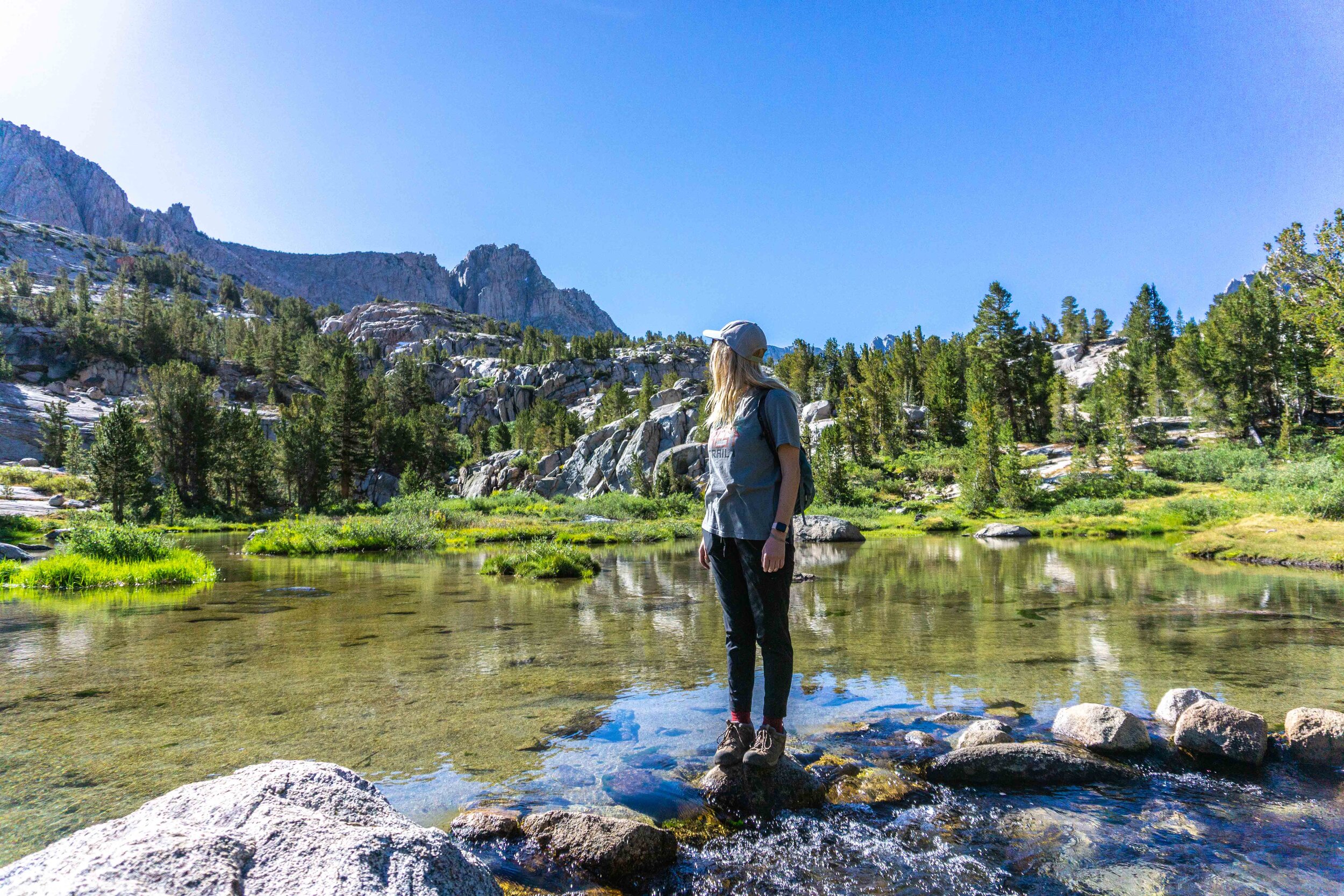
It was the late afternoon on a Saturday when Kaitlin and I started the hike at Sabrina Lake. The trail takes you along side the beautiful Sabrina Lake, steadily headed up towards Blue Lake. Most of the incline for this trip is from Sabrina Lake to Blue Lake (2.5 miles one way), and with a full backpack, you’re going to feel it. Take your time, there’s plenty of beautiful viewpoints to catch your breath and drink some more water.


The higher up the trail takes you, the more you can see some little coves at the very back of Sabrina Lake. They look just like Lake Tahoe’s popular emerald-like coves and I imagine a boat ride back there would make for a great day. You could bring/rent a boat to get to back there, but you may need to swim to shore depending on the depth of the water. After you lose sight of Sabrina Lake and the cute little coves, you’re in the final stretch of incline before reaching the first lake on this trail (well besides Sabrina of course) - Blue Lake.
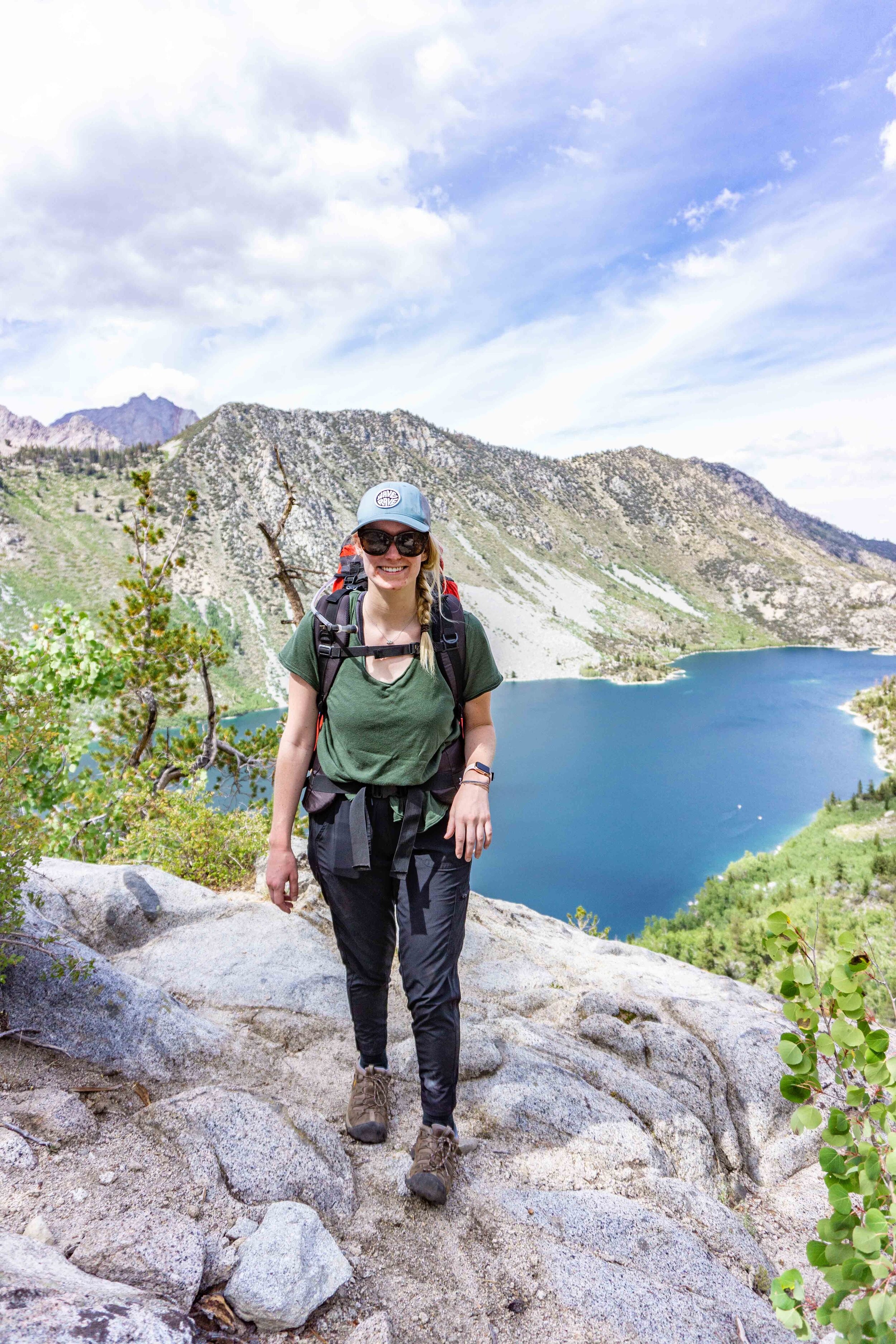
Blue Lake

We ended up camping at Blue Lake, because my backpack was rubbing harshly against my hips (I didn’t have time to get it fitted yet, big mistake). There was an already existing campsite that looked perfect, just off of the trail enough and far enough from the lake. We set up camp and then wandered around the area before coming back to camp for dinner.


After dinner, we headed up to a higher spot near our campsite for some sunset action. It wasn’t one of those ‘blow your socks off’ kind of sunsets, but it was still a treat to watch the light fade from the peaks of the Sierra.


By the time the sun was down, the wind started to pick up. We shuffled back down to our tent to bunker down for the night. We found out that the ‘perfect’ looking campsite seemed to be a perfect wind tunnel as well. It was a loud windy night, but at least we were sleeping in the mountains.
The Next day
In the morning, we woke up after some… not so sound sleep. But nothing some coffee and breakfast can’t fix. I enjoyed some hot oatmeal from my hammock while Kaitlin sipped on coffee to get ready for our hiking for the day.


And then, we were off! As you continue along the trail that’s on the side of Blue Lake, you’ll come across a sign. It points you in the direction of either Donkey Lake or Dingleberry Lake (very charming name, I know). You’re going to head to the right towards Dingleberry Lake (the second lake on this hike). The hike from Blue Lake to Dingleberry has some switchbacks and a moderate incline in the rocky section, but it will soon be followed by flat ground so no need to worry. I wish I got more photos of the magical Dingleberry… but you get the point.
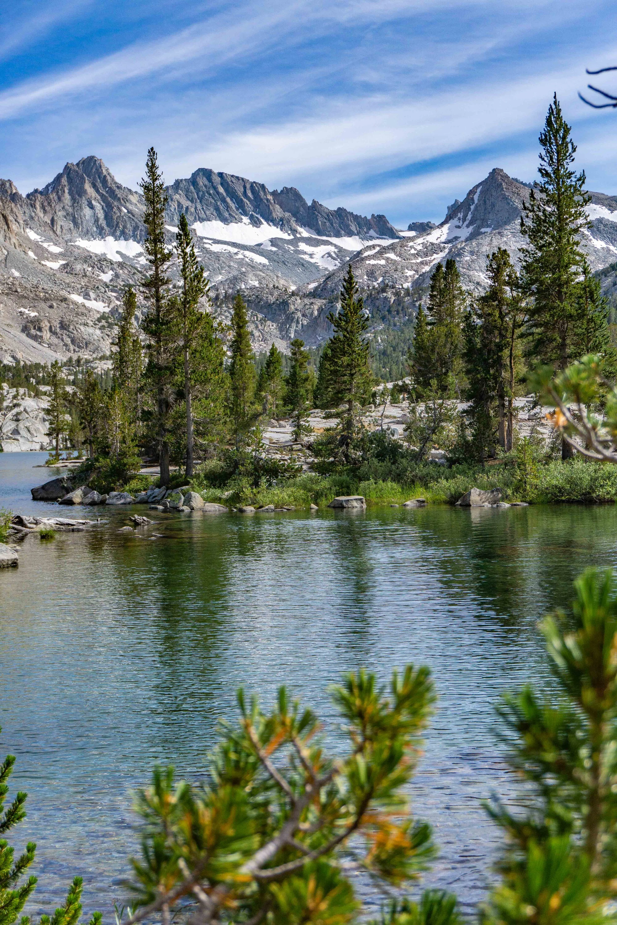
Dingleberry lake

You’ll be above Dingleberry where you first see it, then you’ll make your way down along the side of it. There was a group of backpackers camping near Dingleberry, it looked like some good campsites at the very end of the lake. Blue Lake to Dingleberry Lake was about 1.5 miles so it wouldn’t be difficult to set up camp here instead of Blue Lake. After passing Dingleberry, you’re going to cross a wide section of the Bishop creek. There are enough stones to get across without getting your shoes wet, just be sure to feel out which rocks are wobbly or stable.
We had about 2.5 miles to go before reaching Hungry Packer Lake - and that’s if you’re not checking out the other lakes/meadows/waterfalls on the way which will take you off trail a bit and add some distance.


The next lake we encountered was Topsy Turvy Lake (making some improvement on lake names from Dingleberry). It may be hard to tell from the photo, but it was a decent distance down from the trail so we decided not to head down there, mostly because I was more eager to find the Moonlight Falls. We enjoyed the view of the lake from the trail where you can see how intense the color of the lake is.
Topsy turvy lake

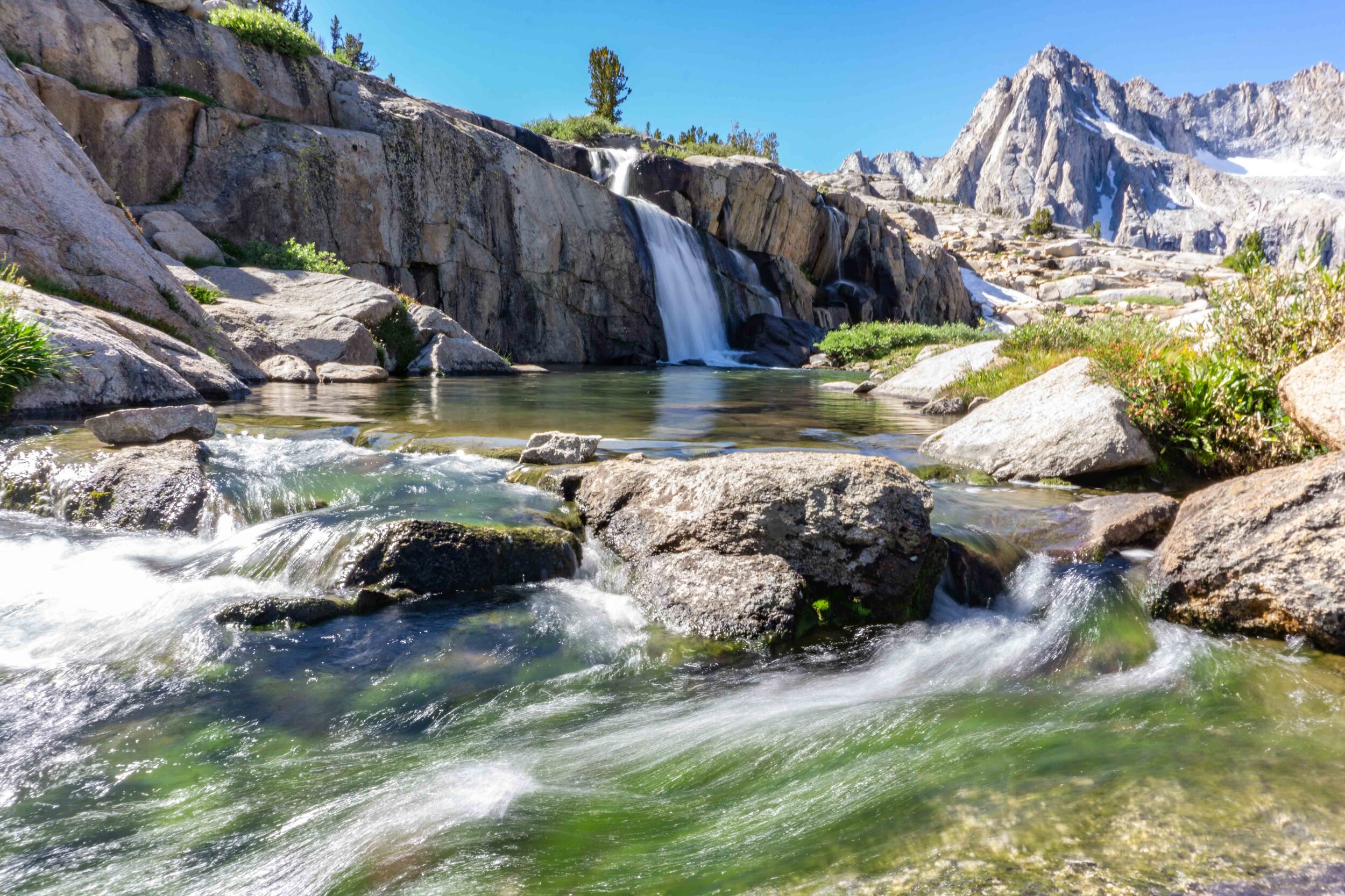
Looking back now, it wouldn’t have been too far off to connect from Topsy Turvy Lake to Moonlight Falls, but now I just have more reason to come back. Onto my favorite section of this hike… Moonlight Falls. I saw a photo of these beautiful falls on the US Forest Service’s information page for Sabrina Lake and I just had to see it for myself. It was a gamble whether the falls would have much water or not, because we were hiking in September. Luckily with such a big winter prior to this summer, the falls were still flowing at good amount.
Moonlight falls


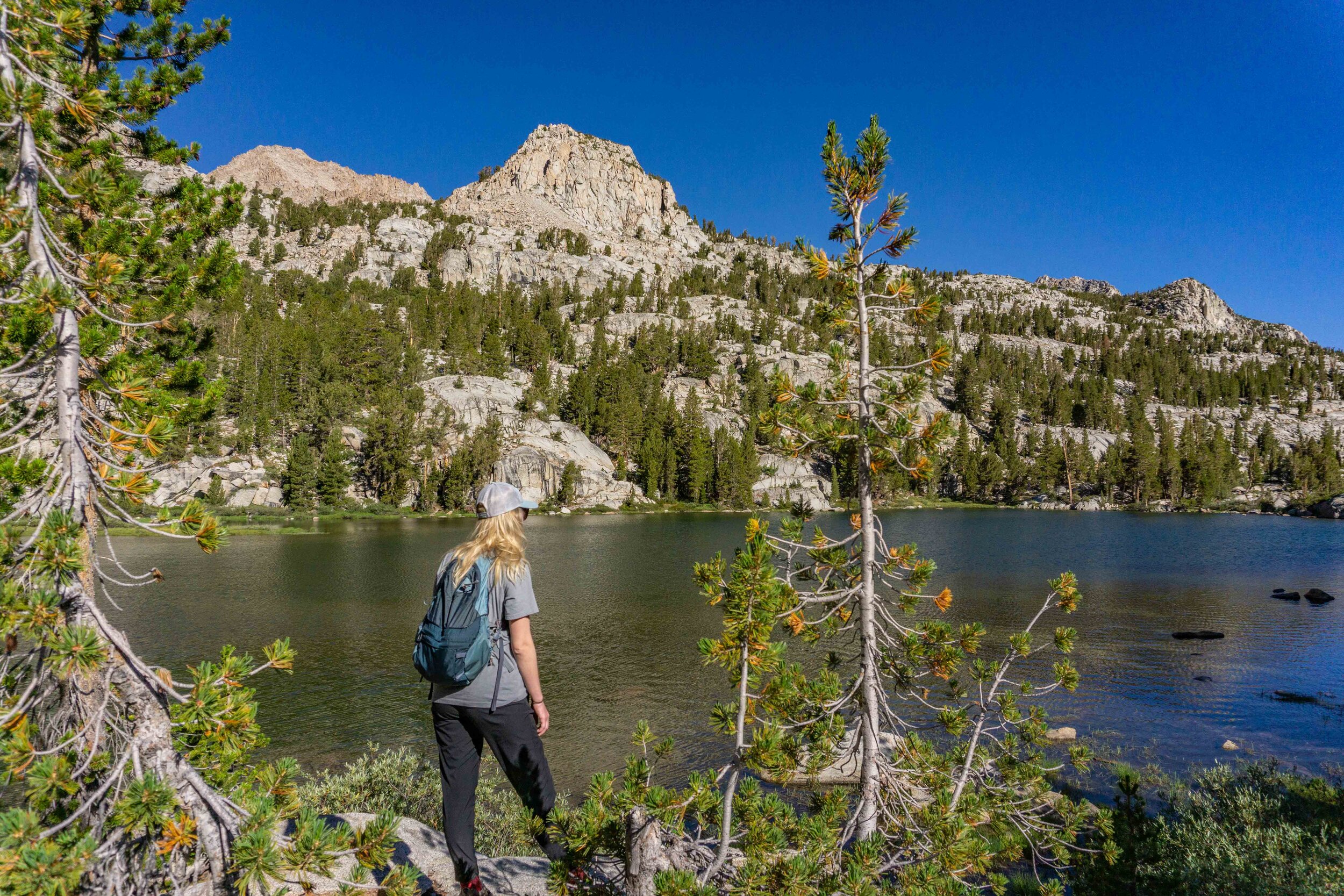
After taking a lot of photos, videos, and wishing I brought my tripod (rookie mistake), we headed back to the trail to reach our final destination - Hungry Packer Lake. In the final stretches of this trail, you’ll also pass Sailor Lake. It’s a shallow, but beautiful little lake. The trail wraps around Sailor Lake so you don’t have to add any distance to enjoy this lake.
Sailor Lake


Not too much further, you’ll start to see the color of the creek look more and more like some sort of Gatorade flavor. The color is undeniably beautiful with a stunning peak background (the peak is called Picture Peak).
Hungry packer lake

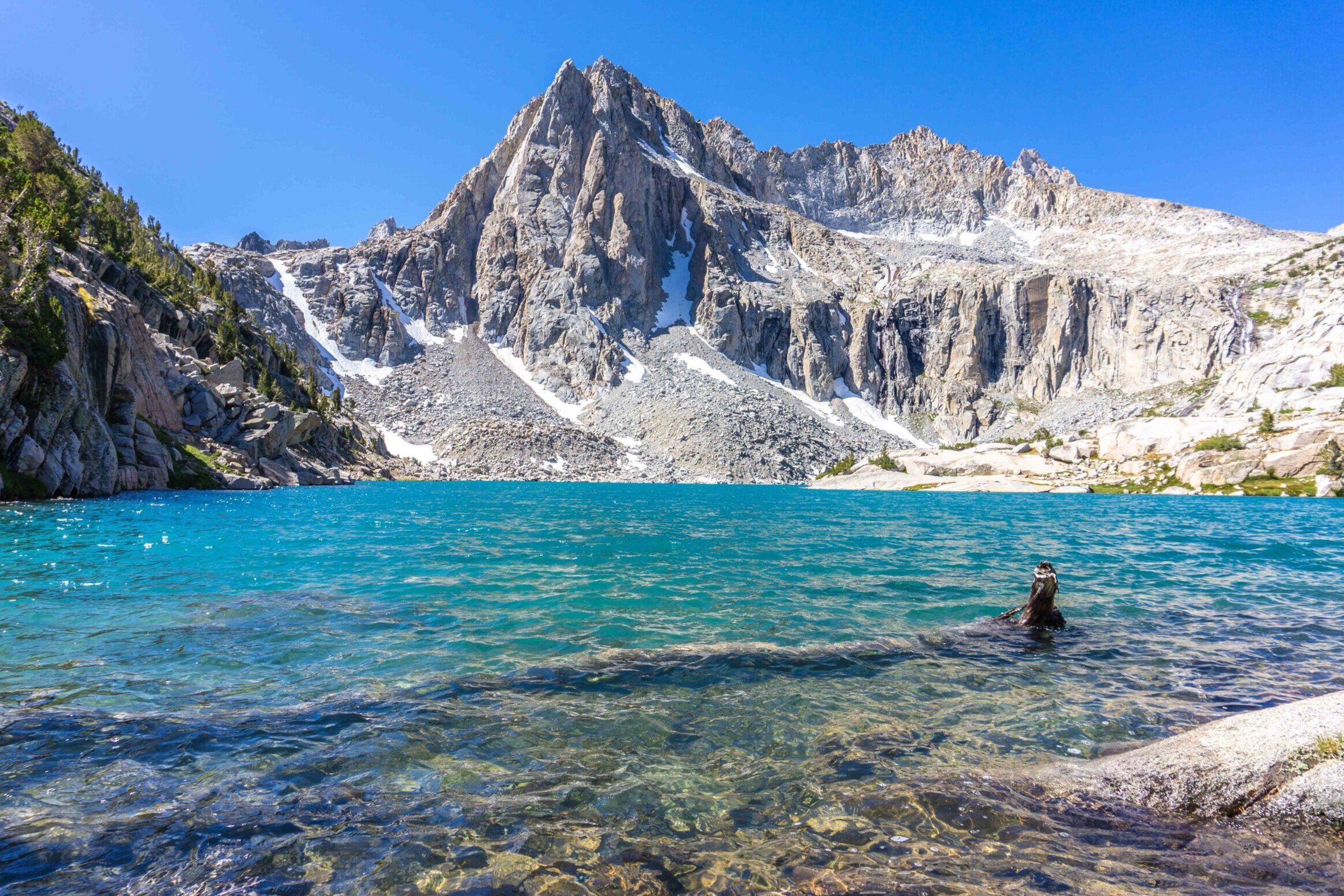
And what a final destination it was. Stunning gatorade blue waters with a striking mountain backdrop… typical Eastern Sierra showing off it’s beauty. After enjoying our time at Hungry Packer Lake, we headed back to Blue Lake. We packed up our campsite and headed back down to my car at the trailhead (6.5 miles to go directly from Hungry Packer Lake to Sabrina Lake). I definitely will be making my way back to this area this summer (pandemic pending I suppose…), because there were many more lakes and many more little treasures to be found. I hope this helps you plan a trip out this way or just gives you a little mountain happiness. Here’s to hoping we’ll be back out hiking on beautiful trails soon, but until then, everyone stay safe and Happy Trails!
video of my adventure
PIN THIS for later!


Thanks for reading my latest adventure!

Tiare Kirkland
Hi! My name is Tiare, but you can just call me ‘T’. I’m a California based hiker and I spend most of my free time taking photos and videos of some of my favorite hikes. You can usually find me ‘Out Hiking’ in the Sierra Nevada mountain range or road-tripping to new areas. Read more about me here and follow along with my adventures by subscribing below!