
Hiking Golden Canyon, Red Cathedral & Gower Gulch Loop (Death Valley National Park) - Trip Report
This loop is a great way to hike through the beautiful views from Zabriskie Point without the crowds. This trail features such varying landscapes and colors, it’s the perfect hike to get a taste of Death Valley. The canyon can get windy, so try to avoid windy days on this trail if you can, I got a lot of dirt in my eyes from this trail. Also this trail does feature some minimal rock scrambling, which was decently easy in the direction I went because I just had to rock scramble down a few features.

Hiking Information
Location: Death Valley National Park (along the Badwater Road, close to Furnace Creek)
Trailhead & Parking: Google Maps
Date Hiked: March 10, 2021
Trail Type: Loop
Elevation Change: 1,018 ft
Distance Roundtrip: 5.1 miles
Nearest Restrooms: at the trailhead
Fees: There is a fee to enter Death Valley National Park, here is information on Death Valley entrance park fees.
Season Accessibility: Year round, but it’s only safe to go when the temperatures are low enough, typically late fall through late spring.
Trail Tip: Starting at the Golden Canyon and ending at Gower Gulch will allow you to only have to rock scramble down (versus going the opposite way and having to rock scramble up).
The Drive/Parking
The trailhead for this hike is along the Badwater road, and has a sign that says Golden Canyon. The parking lot isn’t very large, I’d say about 20 cars max could fit in this parking lot. The parking lot was full when I returned to my car, a little after 10:00am on a Wednesday morning. There’s also a small bathroom at this trailhead. Which way you start this loop is up to you, but I do recommend starting with Golden Canyon and ending out of the Gower Gulch just because of the scrambling section.

The Hike
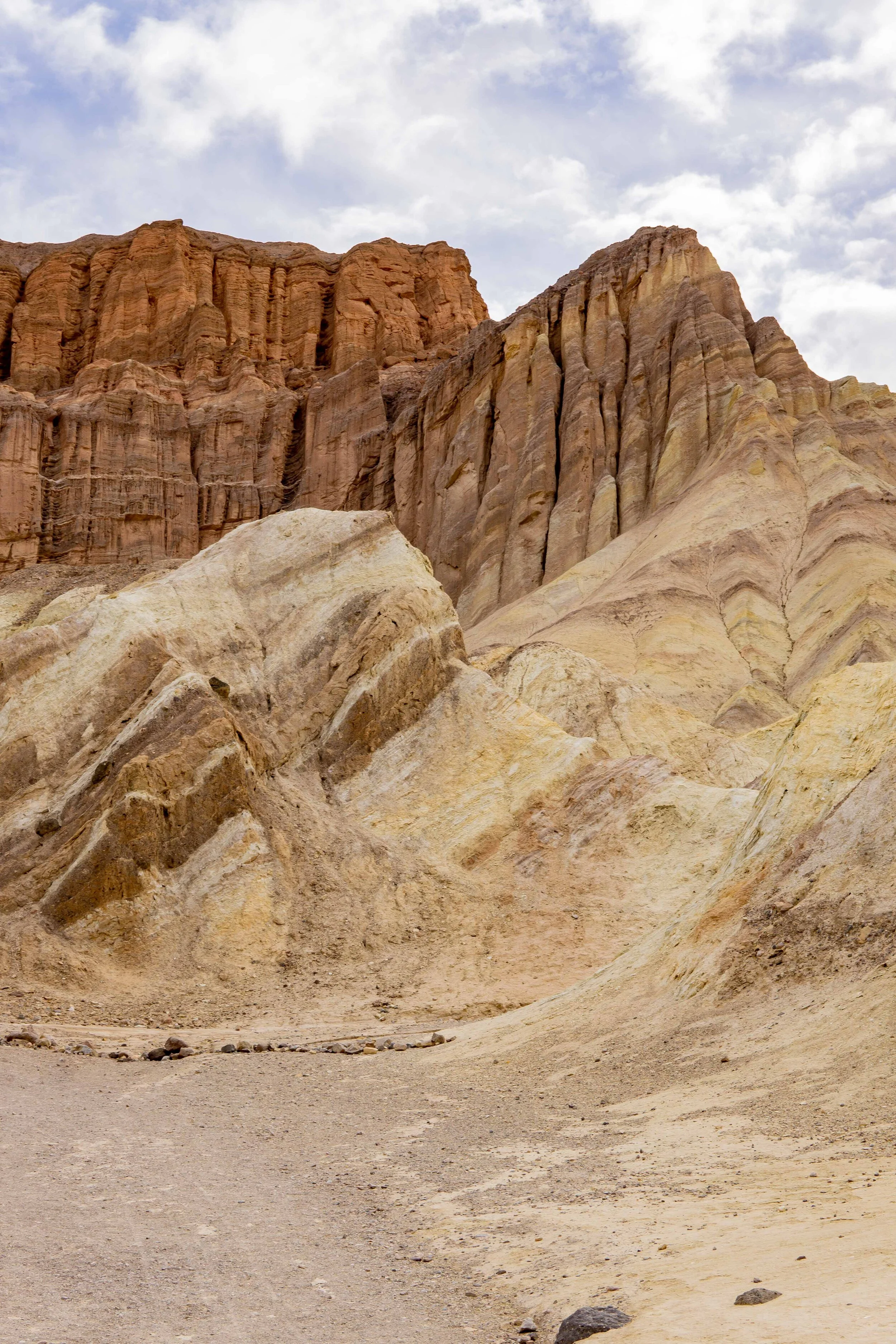
I headed out in the early morning on a Wednesday and the trail starts out through the Golden Canyon. The weather was overcast so I didn’t get the full golden experience that happens when the sunlight hits these impressive canyons. Regardless of the clouds, this trail was absolutely stunning. The canyons featured different hues of golds, tans, browns, pinks, even a few green-ish spots, more of a pastel green.


A mile into the Golden Canyon trail is the Red Cathedral junction. I opted to add the Red Cathedral to my hike to check out those beautiful red rock formations I could see off in the distance. I was really glad I added this section into my hike, there were some stunning rocks along the way.

Junction sign

Almost to turn around point

On the way to Red Cathedral

Turned around a little bit after this point
Getting closer
Stunning views with the sunlight on the way back to the junction sign
I got as far as Gaia Maps showed the Red Cathedral trail to be and then headed back to the junction sign. It appeared that people hiked even closer to the base of Red Cathedral, but I’m not usually one to follow social trails.

Sunny views on the way back to the Junction sign

Little junction sign in the distance
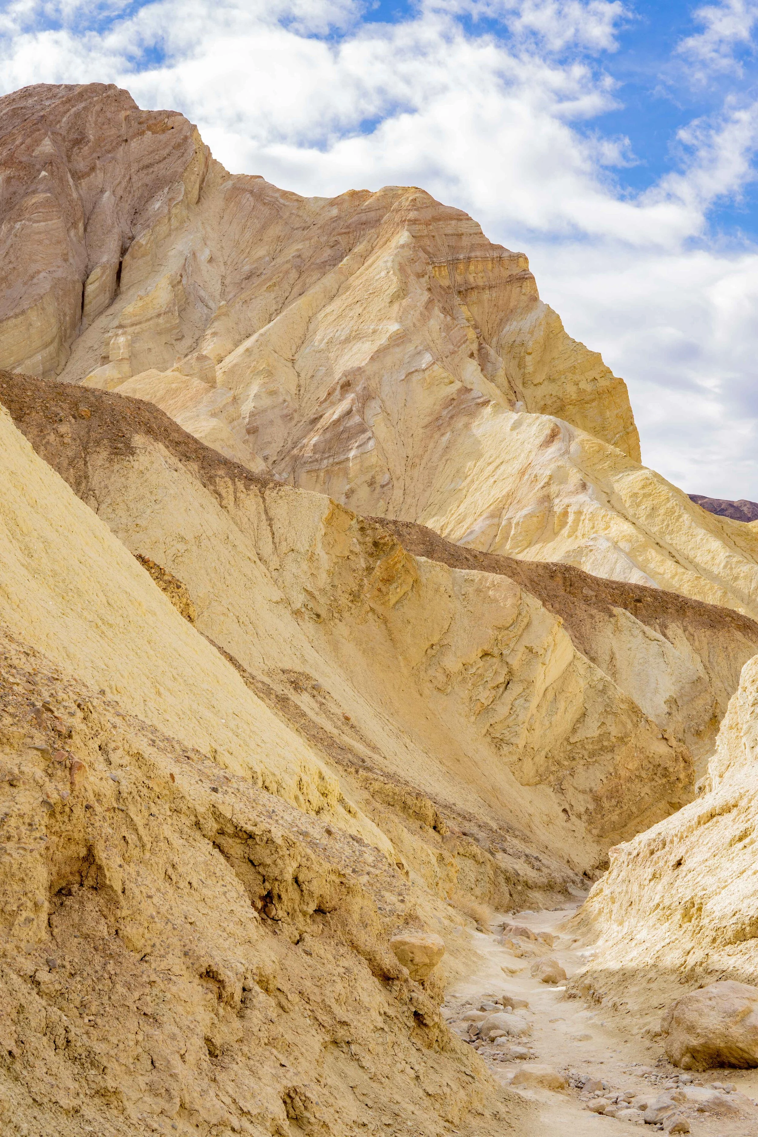
Now back at the junction sign, I jumped back on the Golden Canyon trail. The trail’s incline increased after the junction sign and rewarded me a stunning view of Manly Beacon, a large and beautiful feature found along this hike.


Steeper incline in this part of the hike

Getting closer to Manly Beacon

Views along side the trail
Manly Beacon was stealing the show for me until I turned around to look back at what I just hiked up. Such a beautiful view, some of what you can see from Zabriskie Point but without all the crowds. When I see views as great as this one on the trail, I get so overcome with joy and happiness. And I like to thank my body for getting me to these magical places.


Onward! Once I reached the base of Manly Beacon, the trail goes back down a little bit. I could actually see Zabriskie Point from this part of the trail, I checked out that area when I first arrived to the park the day prior. After not too long, I reached the Badlands Junction where I could chose to head towards Zabriskie Point or continue along this trail until it met up with the Gower Gulch trail junction.

Almost to the base of Manly Beacon

Where the trail heads down, these two were the only people I really saw on the trail

Looking back at Manly Beacon once I was down the trail a bit

Badlands junction

Continue on towards Gower Gulch junction
About a quarter of a mile down the trail is the Gower Gulch junction, the trail splits off to either the Zabriskie Point or the Golden Canyon trailhead. I headed back to the Golden Canyon trailhead via the Gower Gulch at this point.


The Gower Gulch section of this hike resembles a dried up river bed that goes along next to beautifully colored rocks. It was pretty neat that each section of this hike took on a completely different look. The wind definitely made its way through this section of the hike, making it hard for me to look up with the dirt in the wind.

Small scrambling section


Parking Lot
Then I made it to the scrambling section, which was fairly easy to head down, but it might have been hard had I done this loop in the opposite direction. After that, the trait exits the canyon and goes along side the Badwater Road. It wasn’t too close to the road but I could see the cars passing by. It wasn’t much longer until I saw the parking lot come into view and it was definitely full now. After reaching my car and enjoying that I was out of the crazy wind, I treated myself to a nice burger at The Ranch near Furnace Creek. I swear… burgers taste the best after hikes. This trail was a treat and probably my favorite of my trip, I hope you enjoyed my trip report and/or video, and as always… Happy Trails!
VIDEO OF MY ADVENTURE
PIN THIS for later!


Thanks for reading my latest adventure!

Tiare Kirkland
Hi! My name is Tiare, but you can just call me ‘T’. I’m a California based hiker and I spend most of my free time taking photos and videos of some of my favorite hikes. You can usually find me ‘Out Hiking’ in the Sierra Nevada mountain range or road-tripping to new areas. Read more about me here and follow along with my adventures by subscribing below!